The Mapping section in Logitrac provides a visual overview of your fleet’s current locations and activity. It allows your team to locate vehicles, review their latest device readings, view historical travel information, and manage dealership geofences from one screen.
Accessing the Mapping Section- Log in to your Logitrac account.
- Select Mapping from the navigation bar at the top of the screen.
- The Track tab will open by default and display your fleet on the map.
The Mapping section contains three primary tabs:
- Track: View current vehicle locations and statuses.
- History: Review a vehicle’s location and travel history.
- Geofence: View existing geofences or create a new geofence.
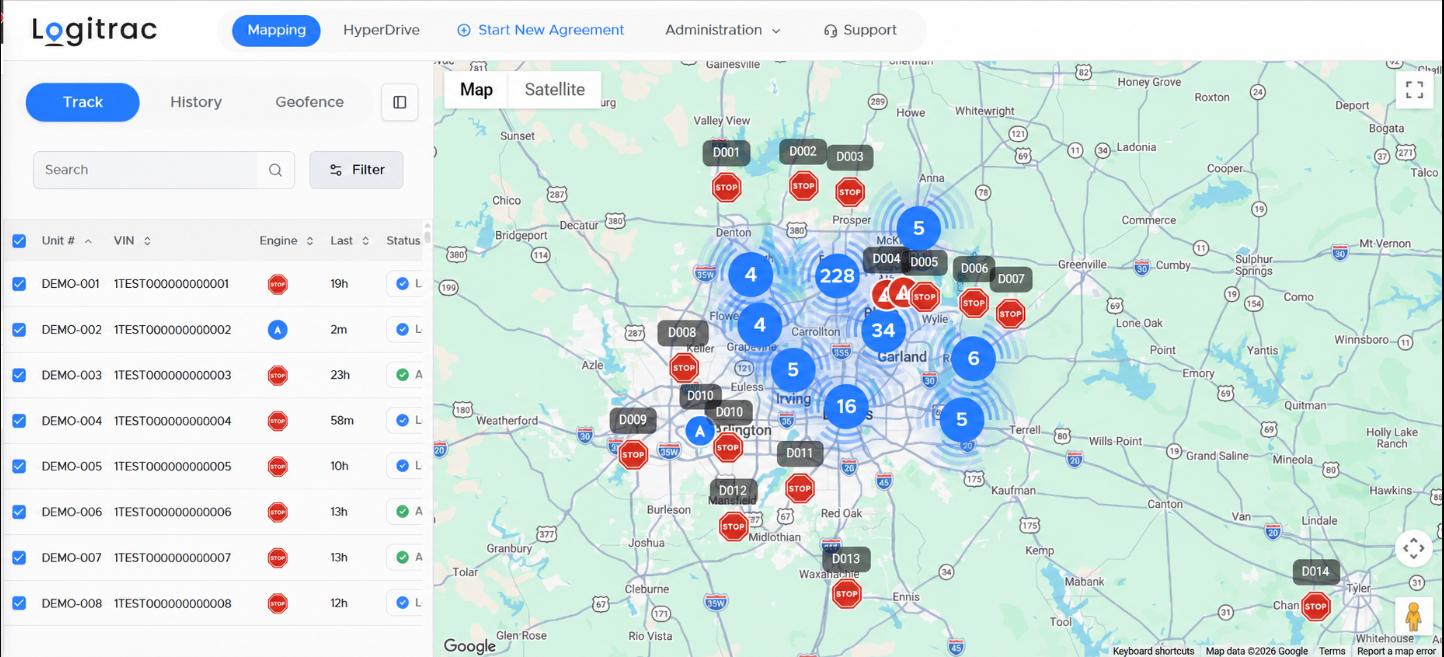
The Track tab displays a list of your fleet vehicles beside an interactive map. Each vehicle is represented by an icon based on its most recently reported activity.
The vehicle list may display information such as:
- Unit number
- VIN
- Engine status
- Time since the last device reading
- Vehicle or agreement status
Use the checkboxes beside each vehicle to control which vehicles appear on the map.
Understanding the Mapping IconsIgnition Off
The red stop sign indicates that the vehicle’s ignition is currently off based on its most recent device reading.

Vehicle in Motion
The blue arrow indicates that the vehicle is currently moving. The arrow points in the vehicle’s reported direction of travel.

Vehicle Idle
The yellow caution icon indicates that the vehicle’s ignition is on, but the vehicle is not currently moving. This may appear when a vehicle is stopped at a light, parked with the engine running, or otherwise idling.

Device Not Reading
The red warning icon indicates that the tracking device is not currently reporting or may not have successfully reported a location. This may require the dealership to inspect the device or confirm its installation.

Vehicle Clusters
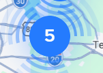
When multiple vehicles are located near one another, they may be grouped into a blue cluster. The number inside the cluster shows how many vehicles are located within that area.
Select the cluster or zoom in on the map to view the individual vehicles.
Use the vehicle list or map to locate a specific vehicle.
Searching for a Vehicle
- Enter identifying information in the Search field.
- Search using information such as the unit number or VIN.
- Select the matching vehicle to locate it on the map.
You can also select Filter to narrow the vehicle list using the available filtering options.
Selecting a Vehicle on the Map
Select a vehicle icon to view additional information about that vehicle. The available details may include its current status, most recent location, speed, direction, and time of its last device reading.
Use the Map and Satellite options to switch between the standard map and satellite imagery. You can also zoom or expand the map to better view a vehicle’s location.
Viewing Vehicle HistoryThe History tab allows you to review a vehicle’s previously reported locations and activity.
- Select History at the top of the Mapping panel.
- Choose the vehicle you want to review.
- Select the desired date or date range.
- Load the results to display the vehicle’s available history.
Vehicle history can help your team review routes, stops, movement, and other reported activity during the selected period.
Viewing and Creating GeofencesThe Geofence tab allows your dealership to view existing geofences and create new ones directly from the Mapping section.
To create a geofence:
- Select Geofence at the top of the Mapping panel.
- Choose the option to add a new geofence.
- Define the desired area on the map.
- Enter the required geofence information.
- Save the geofence.
Geofences can be used to define important locations or boundaries, such as the dealership lot, storage facilities, service locations, or other frequently monitored areas.
By using the Track, History, and Geofence tabs, your dealership can quickly locate fleet vehicles, review past activity, and maintain the geographic boundaries used to monitor fleet operations.